Burnhouse (The Whisky Well Cottage).

The cottage was built during c. 1873 for John Watson who later became the Baronet of Neilsland and Earnock. This was whilst improvements were being made to his recently purchased Neilsland estate. It is interesting to note that there was a “Burnhouse” cottage on the exact same site that was demolished to make way for the existing one! This can be easily referenced by looking at older maps.

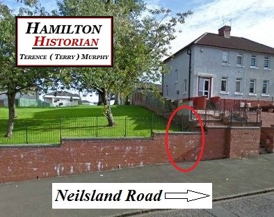
The cottage is located at number 51 Neilsland Road, Hamilton, South Lanarkshire, Scotland ML3 8NA (just off the T-Junction of Neilsland Road/Swisscot Avenue). Burnhouse and it’s Boundry Wall are a Category Grade C British Listed Building. The cottage also lent it’s name to the nearby housing area “Burnhouse Crescent”.

The original intended purpose for the building is unknown although Mr Alex Reith who was Estate Factor for Neilsland and Earnock lived there for a brief spell before moving to Hillhouse Farmstead (Homefarm), which was also owned by John Watson.

The design of the cottage is attributed to William Leiper with a 20th Century addition to NE (the side extension was built during the early 1990’s). Single storey, 4-bay, roughly rectangular-plan, estate cottage with finialed crowstepped gables and bipartite windows. Squared, stugged orange sandstone with polished ashlar dressings. Base course to front elevation only; moulded eaves cornice; moulded skew putts. Roll-moulded windows and door margins to front, chamfered window margins to rear; relieving arches above front windows.

SE (PRINCIPAL) ELEVATION: central timber-panelled front door with stone slab canopy supported on moulded brackets to SE (principal) elevation; 2 tiled steps to door.

Bipartite window to left door; crow-stepped dormer-head with half-moon finial and monogram. Slightly advanced gable to right with paired window; spiky ball-finial to gablehead; monogram JW in square panel above window. Piened-roofed 20th Century addition to outer right with bipartite window.

OTHER ELEVATIONS; slightly advanced gable with thistle finial and blind slit window to SW (road) elevation; stone bollard in re-entrant angle; truncated stack above. 2 gables flanking central bay to NW (rear) elevation; irregular fenestration with oval window to right gable; 20th Century addition to outer left.

Plate glass in timber sash case windows.

The current owner of the cottage is Mrs Kay Hamilton who is the spouse of the late Jim Hamilton. Jim along with his Mother and Father William (Wullie) Hamilton moved to the cottage during c. 1940. During c. 1945 Wullie Hamilton had three shops built next to the cottage; 1): A Newsagents, 2): Butcher shop, and, 3): A Grocery Shop. Twelve years later c. 1957, he built a pub and named it: “The Whisky Well”. The pub was eventually sold to Tennant’s Brewery during c. 1960. In more recent times the name of the pub was changed to: “The Duke Inn” and it sadly lay derelict for some years but it is now being leased to William Hill Bookmakers who sublet the pub and thankfully have restored the original “Whisky Well” name!

As previously mentioned the stone carved monogram initials on a square panel above a window are ” JW ” for John Watson and not ” DW ” for Douglas Watson as incorrectly documented in the past. Douglas Watson was the grandson of John Watson and Burnhouse was built some 20 years before he was born. He was the last person to live at Neilsland House (formerly Mid Stonehall) as it was his parents home, they were: Thomas and Lucy (Hamilton) Watson. Thomas was the second oldest son to Sir John Watson Bt of Neilsland and Earnock and when he married Lucy Hamilton his father gifted him the estate as a wedding present. Their oldest son Douglas inherited the estate and buildings tied to it upon the death of his mother. I believe it was Douglas who sold Burnhouse (The Whisky Well Cottage) to William (Wullie) Hamilton.

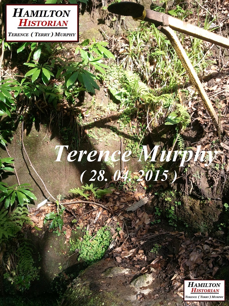
The Grade C Listed Boundry Wall for Burnhouse is not the original one! The original wall was tiered in three sections and adjoined a small decorative ” Well-Shaped Finial ” which marked the location of the burn and fenced-off access point to the naturally occurring spring within the grounds. The spring was known locally as ” The Whisky Well ” and it is the true origin of the name!

It was a raised natural basin that continuously filled-up with water and sat just above the nearby burn in the grounds of Burnhouse. The term “Whisky Well” was first used to describe the spring by Douglas Watson who claimed that the water from there was the only water around that mixed with his whisky. So, because the spring was known locally as the “Whisky Well” and it was located within the grounds of Burnhouse and a small decorative “Well-Shaped Finial” marked it’s access point location, Burnhouse also became known as “The Whisky Well Cottage” and subsequently Wullie Hamilton also named his pub “The Whisky Well”.

The naturally occurring spring which was the original Whisky Well, is now a dried-up area of waste ground. The spring and nearby burn are both in essence the same source which, is an underground estuary of the Cadzow Burn. The burn still runs through the grounds of Burnhouse (Whisky Well Cottage) and the storm drains overflow link up from Swisscot Avenue also drain into it. The original tiered wall, decorative well-shaped finial and fenced-off access point to the spring were all replaced by one continuous wall of the same level. This present day existing wall was most likely built around the same time as the local housing in the area. A small “Weephole” was added to the wall to avoid flooding to the road and pavement. It is this Weephole that marks the former location of the small decorative “Well-Shaped Finial” and fenced-off access point to the spring which once was ” The Whisky Well”!

Written By

Hamilton Historian.

Terence (Terry) Murphy.

ref: A special mention to the late Jim Hamilton R.I.P. The former owner of Burnhouse (Whisky Well Cottage) who documented the details of Douglas Watson originally naming the spring “The Whisky Well” in a locally produced small booklet on the history of the area titled: ” Our Story ” c. 1986. And also the Sir John Watson Journals and the British Listed Buildings Site.

Meikle Earnock Station.

This is a photograph of Meikle Earnock Station c. 1940 approx. It was opened c. 1863 by Hamilton And Strathaven Railway Company and titled; “Meikle Earnock Station” and then subsequently titled; “Meikle Earnock Halt” between c. 1941-1943. The station had two platforms. A waiting shelter was located on the northbound platform, heading towards the old Neilsland (Midstonehall) Estate. And, a small station building was on the southbound platform.

East side of the station was a small goods yard and a signal box, there was also a small railway cottage located nearby. The cottage still exists today and is a private residence. The station closed to passengers c. 1943. After c. 1945 the box was only open as required. It was closed during c. 1953 when the railway closed.

Between the late 1970’s and early 1990’s the site of the former station served as a swing park complete with it’s very own wooden fort (for playing cowboys and Indians). This was a popular stop-off point for families who were visiting the nearby “Beechfield Garden Centre” which was located further up Meikle Earnock Road (next to Andrew Baird’s farm) and owned by his Grandson.

Written By

Hamilton Historian.

Terence (Terry) Murphy.

ref: Railscot.co.uk.

The “Peephole” Location Continued.

Hamilton Historian. Terry Murphy standing at the former location of the Peephole. Now at the foot of Fairhill Avenue, Hamilton, South Lanarkshire, Scotland. The Peephole was located on a footpath bridge that connected the Gate Lodge for Fairhill House to the House. The Bridge also intersected the Cadzow Burn.

The tallest building behind me in the photograph is Ivy Grove and was once locally known as the “Majors House”, after an army major who lived at the address. It was recently renovated. This building along with several others including “Hollandbush” (which also still survives to this day) were originally built as houses for the wealthy Glasgow born coal merchants who opened all the nearby coalfields and pits. Ironically at a later date, pits were developed close by to their houses and this no doubt would have annoyed them as they were originally intended to be out of the way, in their own separate little ” Pleasant Land”!

The lands of Ivy Grove were known as “Ivy Wood”, My Mother and Father’s Group Wedding photo was taken at the top of the former site of Ivy Wood, across the road and just up from the “Hilltop Bar and Lounge” where their reception was held and this is now the site of the Scotmid Co-Operative store. Just left in the photo a small outbuilding for Ivy Grove is visible. My mother would often recount the funny story about her veil blowing up onto the trees and My Father and Uncle having to climb them to retrieve it.

Left – Right: My Paternal Great Uncle John Murphy, My Paternal Great Grandmother Helen “Nelly” (Montgomery) Murphy, My Paternal Grandfather Alexander “Axe” Murphy, My Paternal Grandmother Mary (McManus) Murphy, My Mother’s Bridesmaid and Friend Helen Ging, My Father Terence John “Terry” Murphy, My Mother Marion (Simpson) Murphy, My Uncle Alexander “Lex” Murphy, My Maternal Great Grandmother Marion (McGroarty) McCallum, My Maternal Grandmother Bridget (McCallum) Simpson and My Maternal Grandfather James “Jimmy” Simpson. R.I.P. The only two surviving people from the photograph are the Little Flower Girls: My Older Cousins, Sharon (Mathieson) Aubrey on the left and Denise Mathieson on the right.

Written By

Hamilton Historian.

Terry Murphy.

The “Peephole” Location.

There has been much confusion over the years regarding the origin of the term “Peephole” and as to where exactly it was located within the Fairhill area of Hamilton, South Lanarkshire, Scotland. Many people believe that it was the name given to the location of a viewpoint at the start of a pathway which was at the top of a set of stairs beginning at Mill Road leading down into the valley of the Cadzow Burn and up past the former Fairhill House (which the area is named after). It is also theorised that youngsters from this point would spy on courting couples who met each other on the nearby “Lovers Lane” , approximately between where Alness Street and Croftwood Road are now located.

I believe that the term “Peephole” was adopted during the Killing Time by the Covenanters and their supporters from Fairhill House and the nearby ancient village of Meikle Earnock. It would have been used to describe the intersection point between the Cadzow Burn and an old footbridge that formed part of a footpath leading from the Fairhill House Gate Lodge located on Mill Road down into the valley over the burn and up to the House. The Peephole footbridge was raised above the ground, so that you could travel over the burn. It would have had a fence or wall on either of it’s sides, with a spyhole or the said “Peephole” providing a long view point down through the Cadzow Burn Valley. So that they could see if the King’s soldiers were advancing towards them! In later years another small footbridge was installed just a few feet away and in line with this one. It was linked to the fore mentioned path and stairs beginning at Mill Road that people confuse with being the Peephole location. You can easily reference this on old maps.

There is also the nearby Neilsland Burn that runs down past the former Laigh Stonehall farmstead, which is now the location of Buchanan Crescent, Fraser Crescent, Westwood Crescent and Hardie Street. The confluence point (where the Neilsland Burn flows into the Cadzow Burn) is marked by another small footbridge at the bottom of the lane at the side of the Mill Inn Bar. The house I grew up in overlooks this area and it was my playground!

It is further along the same valley that the Laighstonehall Covenanter lies in an unmarked grave! I believe that he was making his way towards the Peephole and ultimately Fairhill House to seek refuge with the “Laird Old James Strang”: Brother to Covenanter Martyr Christopher Strang. During the Killing Time the landscape was open as this was long before the housing, streets and even collieries were developed. The length of the Cadzow Burn that the Peephole footbridge and path intersected also lay open during this time and it wasn’t until long after all of the local housing areas were established that the burn was enclosed within an underground tunnel pipeline. Starting at the foot of the bing (bottom of Neilsland Colliery area) and ending on the other side of Millgate Road. The Cadzow Burn tunnel exit point at Millgate Road was built from local blonde sandstone during the Victorian era to originally support the Fairhill Colliery railway line and subsequently Millgate Road!

Approximately two thirds of the length of the Cadzow Burn tunnel lies beneath Fairhill Football Park (the pavilion/changing room is where the Fairhill House Gate Lodge was located). The location of the football park is the lowest centre of gravity within the valley as is the area which used to be a small ash covered 5 a-side pitch behind the Millgate Road tunnel exit point. Hence the reason why many matches are cancelled due to flooding!

The topography of the Cadzow Burn valley has not changed much in hundreds of years and it is the nucleus of the area. There is a Roman Tumulus located near the edge of this valley suggesting that there may well have been some small kind of Roman settlement in the area. My theory is that a Roman centurion/soldier may have broke away from the garrison stationed at Bothwellhaugh and formed his own homestead here. And, when he and his kin died they were cremated and their ashes were placed in the terracotta (earth-baked) urns that were interred in the tumulus many years ago.

Written By

Hamilton Historian.

Terry Murphy.

THE NEILSLAND MONSTER.

Extract from The Times, July 27th, 1934.

THE NEILSLAND MONSTER.

———–———-

In Torhead Loch situated on Neilsland Estate near Hamilton, in Lanarkshire, there is a monster akin to that of Loch Ness fame. This animal was first sighted by Mrs. Jack while riding round the shores of the Loch early in May this year.

The Beast made a ferocious attack and Mrs. Jack fearful for the welfare of herself and her mount, speedily fled away, she being a horsewoman of great repute in the shires.

The monster was not reported again until Yesterday, when Major Watson was able to photograph it (reproduced on page 18) . The beast appeared quite docile on this occasion which may be accounted for by the fact that on July 25th, a cart drawn by two shire horses mysteriously disappeared while engaged in the neighbourhood of the Loch, and there is no doubt that the animal by now only partially digested his unpalatable feed of that day. May it be said that the cart contained a large quantity of timber at the time of its dis-appearance.

At the time of going to press the Board of Agriculture and Fisheries have engaged a fleet of aeroplanes to convey themselves and many ministers of the Cabinet to Hamilton, at dawn to-morrow, to determine the species and investigate the habits of the monster.

Mr. Watson interviewed by our representative this evening, said that accommodation was being prepared by Mrs. Watson in their home, where the whole party would be their guests. His own office, situated within a stone’s throw- The Swiss Cottage -would be placed at the disposal of the members of the Cabinet, while the Scout’s Hall, a palatial room at Woodhead, would serve the Board of Agriculture and Fisheries.

The Lodge field, with suitable sheds already erected for the host of ‘planes, would act as a landing ground. Mr. Mitchell, with his staff, in conjunction with the Post Office Officials, are employed at present in laying a private line to Westminster, so that the work of the State will not be jeopardised during the Cabinet’s sojourn in the North.

Hamilton Historian. Terence (Terry) Murphy.

Holding the original document: The Neilsland Monster.

Transcribed And Published By

Hamilton Historian.

Terence (Terry) Murphy.

Ref; This historical urban legend was written and created by Jeanette (Watson) Jack c. 27th July 1934. A special thank you goes to Louise Jack (Jeanette’s Granddaughter) for gifting the document to me!

WW2 Air Raid Shelter, Hamilton, South lanarkshire, Scotland.

Hamilton Historian. Terence (Terry) Murphy. At the WW2 Air Raid Shelter located in the former Neilsland (Mid Stonehall) Estate, Hamilton, South Lanarkshire, Scotland.

Many local people would argue that this is in fact the former pump house that powered water connected to the fountain on the estate. I strongly disagree with this theory! There is no documented record for the structure. I have based my opinion on six separate facts, they are;

1): Photos of other WW2 brick built air raid shelters similar to this one in both size and appearance.

2): In the Neilsland House photo which includes the fountain c. 1893, you can clearly see that there is no visible evidence of the structure. The photo was taken some 20 years after the fountain was installed in the estate (early c. 1870’s when the improvements were being carried out). If you were standing at the fountain, facing the original stone stairs the air raid shelter is located approximately 20 yards to the left and 1 terrace up. So, you see this is not the pump house for the fountain or it would be visible in the photo!

3): Sir Simon Watson Bt is recorded as writing that; “There was a control room under the fountain”! This was in reference to his Uncle Douglas Watson who was fined by police for illegally storing petrol there during the Suez Crisis c.1956. This fact further proves that the structure was not a pump house for the fountain!

4): There is no detailed drawing evidence of the structure on the original Neilsland Plan Of The Drains Document c. 1905 by Alexander Cullen Architect. The drawing details the new cast iron drainage pipes installation of the house as well as the ground floor plan.

5): Neilsland House which included the Greenhouse, Hot Houses and Conservatory were all heated via “The Heating Chamber”. This is clearly detailed on the Neilsland Plan Of The Drains (above). There was also a “Coals” store located within the Kitchen Court and this adjoined the Stabling. Therefore, the structure which I believe is a WW2 Air Raid Shelter was clearly not a boiler room for heating the house etc. It was also clearly not a coal store! And it could not possibly be a garage pit for servicing cars as this was located behind the house and nowhere near the structure (air raid shelter).

6): The strongest fact confirming that the structure is a WW2 Air Raid Shelter is that I personally witnessed a local man tap a long steel rod down through the centre point of the fountain base whilst we attended a group guided tour several years back. The steel rod passed down through the fountain base with great ease proving that below the fountain there is a void chamber and this is where the pump house would have been located!

The air raid shelter which sits up on the terraces some 20 yards away would have been built for Lady Lucy (Hamilton) Watson and her Son Douglas (Hamilton) Watson. The structure is capable of holding 4-6 people in a seating position. There is an entrance doorway to the shelter and an escape hatch at the other end. The escape hatch would also have contained some type of breathing air intake device. Both the entrance door and escape hatch are gone. The walls are brick built with a concrete lintel above the door, concrete slabbed roof and a wooden floor.

Written by

Hamilton Historian.

Terence (Terry) Murphy.

Neilsland House & Estate.

John Watson (Later 1st Bt Of Neilsland & Earnock) bought the Neilsland Estate during April of 1871.  Because there was another house nearby in Meikle Earnock called “Neilsland” , the name of the mansion house “Mid Stonehall” was changed to “Neilsland House” and the name of the Meikle Earnock property became “Old Neilsland House”, which was situated exactly where the Woodhead Bar is located nowadays.

old-neilsland-1877
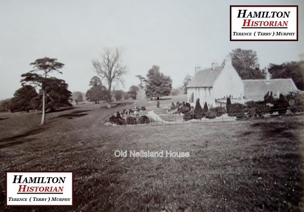
Old Neilsland  House  c.1877  (This is the current day location of the Woodhead Bar).
20190409_204401
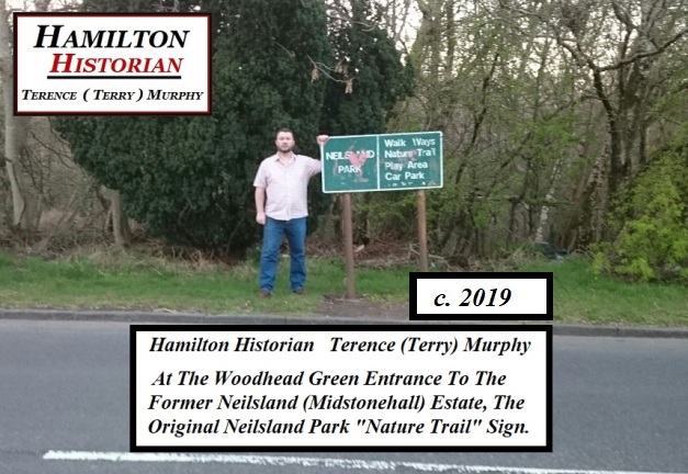
Hamilton Historian  Terence (Terry) Murphy  Standing Beside The Original “Neilsland Park”,  “Nature Trail”  Sign  At The Woodhead Green Entrance To The Former Neilsland (Midstonehall) Estate.

Prior to the Neilsland Estate being put on the market Old Neilsland was leased for 3 years to Mr George Gordon who was a retired building contractor. The exact date that Old Neilsland House and Neilsland Mansion House (Mid Stonehall) were built is unknown and undocumented although both buildings were originally used as farmsteads. The location of the Neilsland Mansion House (Mid Stonehall) was to the left of the top end of Highstonehall Road, between the Woodhead and the Little Earnock Housing Estates. The area has been known as the “Nature Trail” for many years.

1893-neilsland-mansion-house
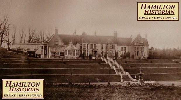
Neilsland Mansion House (Mid Stonehall) c.1873.
_20190409_213625
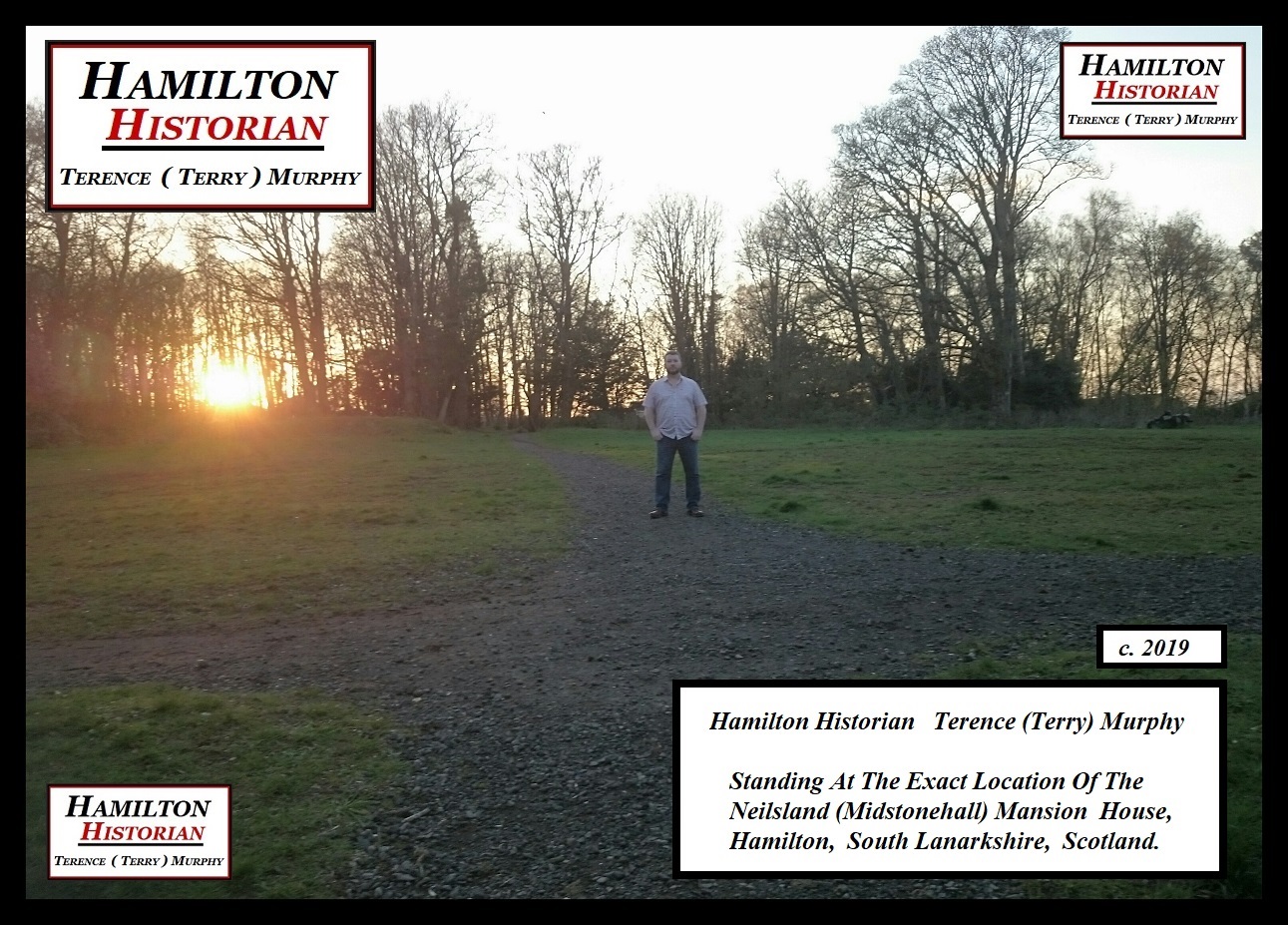
Hamilton Historian  Terence (Terry) Murphy  Standing At The Exact Location Of The Neilsland Mansion House  c.2019.
_20190409_220752 1
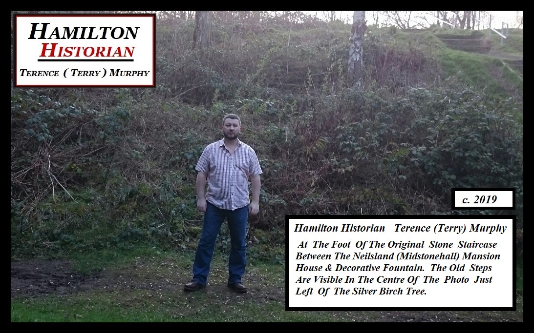
Hamilton Historian  Terence (Terry) Murphy  Standing At The Foot Of The Original Stone Staircase Between The Neilsland Mansion House & Decorative Fountain Below  c.2019.
_20190409_221142 1
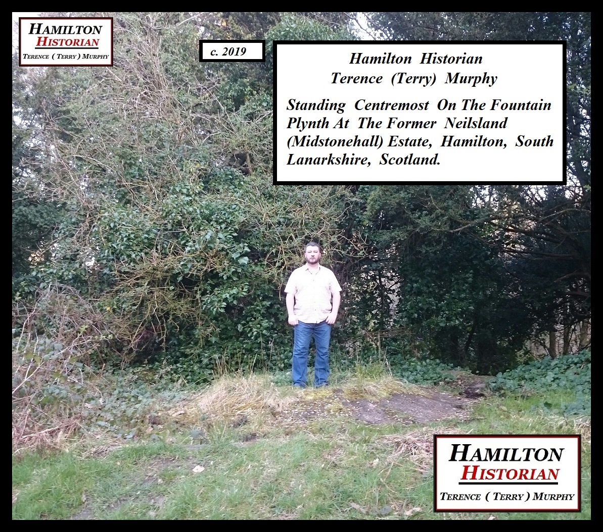
Hamilton Historian  Terence (Terry) Murphy  Standing Centremost On The Fountain Plynth In The Neilsland (Midstonehall) Estate  c.2019.

In the winter of 1872 the gardens of Neilsland Mansion House were improved with the assistance of Mr David Mitchell who was former head gardener to the Duke Of Hamilton. Later in 1873 the development of Neilsland’s policies began. As a water supply for the Neilsland Mansion House, the formation of Tor lake commonly known as the “Tally Hoe” commenced. The lake was situated behind what is now known as the Torhead Farm Housing Estate and is now almost completely dried out and resembles more of a quagmire or swamp. An Arboretum on both sides of the glen was also created along with Rockery and Pond. Work also began on the construction of the Swiss Cottage at this time. Burnhouse (Whisky Well Cottage) was built in 1873, it’s original use is unknown. Although Mr Alex Reith who was the Estate Factor for Neilsland and Earnock lived there for a brief spell before moving to Hillhouse Farmstead (Homefarm) which was also owned by John Watson. The current owner of the cottage is Mrs Kay Hamilton who is the spouse of the late Jim Hamilton.  Jim moved to the cottage during 1940 with his mother and father William (Wullie) Hamilton. In 1945 Wullie had three shops built next to the cottage; a newsagents, butchers and grocers.  And,  twelve years later (1957) he also built a pub named the Whisky Well.  Wullie sold the pub to Tennant’s Brewery during 1960. In more recent times the name of the pub was changed to: “The Duke Inn” and sadly it lay derelict for  some years but it is now being leased to the William Hill Bookmakers  franchise who  sublet  the pub and  have restored  the original  ” Whisky Well ” name!.  After Wullie died during 1962 his son Jim took over the 3 shops. The shops were later converted to one shop and a separate post office store in later years. More recently  the building was converted again to be one shop which incorporated a post office and  Mrs Kay Hamilton still owns and leases the property to (Scotmid/Co-Operative stores) to this present day. 

DSC_0972
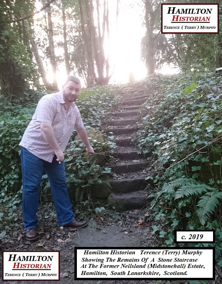
Hamilton Historian   Terence (Terry) Murphy  Showing Stone Staircase Remains  c.2019.

_20190409_213240
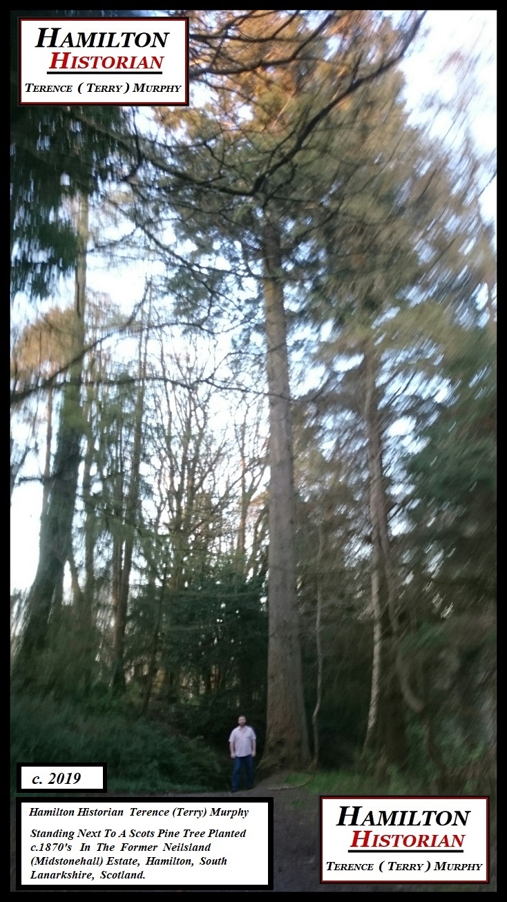
HAMILTON HISTORIAN  TERENCE (TERRY) MURPHY BESIDE A SCOT’S PINE PLANTED c. 1870’S  IN THE NEILSLAND (MIDSTONEHALL) ESTATE  C.2019.

tor-lake-1877
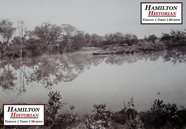
Tor Lake (Tally Hoe)  c.1877.
rockery-and-fountain-at-neilsland-1877
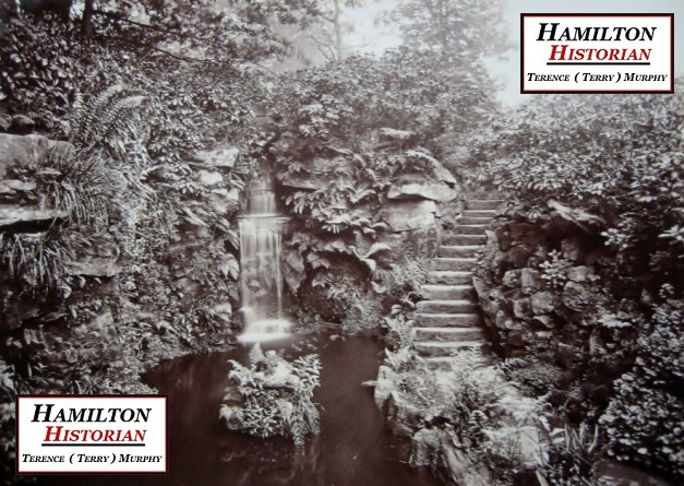
Rockery with Small Waterfall at Neilsland  c.1877.
the-avenue-and-pumpwell-at-neilsland
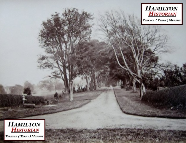
A tree lined Avenue between Old Neilsland and Woodhead was created in 1873. This photo c. 1877.
gamekeepers-house-1877
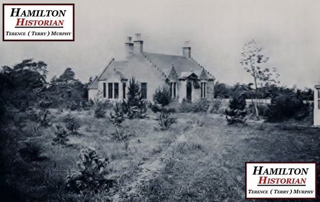
Gamekeeper’s House at Woodhead  c.1877.
cottages-and-gamekeepers-house-1877
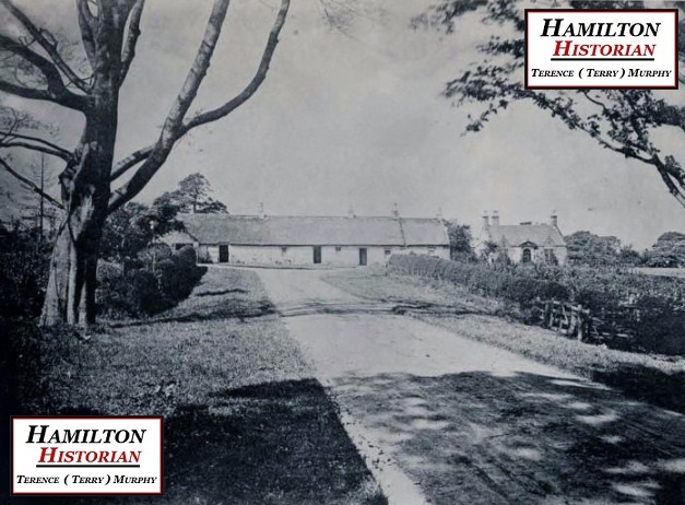
Cottages & Gamekeeper’s House at end of Avenue at Woodhead.  c.1877.
well-at-cottages-and-gamekeepers-house-woodhead-primary
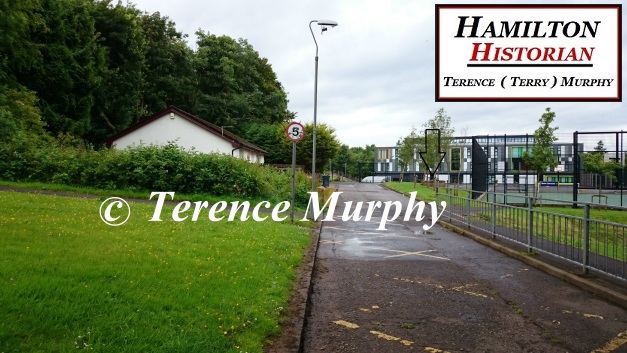
The former location of the Cottages and Gamekeeper’s House at the end of the Avenue at Woodhead. The arrow marks the location of the well which is also visible in the 1877 photo. Woodhead Primary is in the background  c.2016.
_20190427_145627
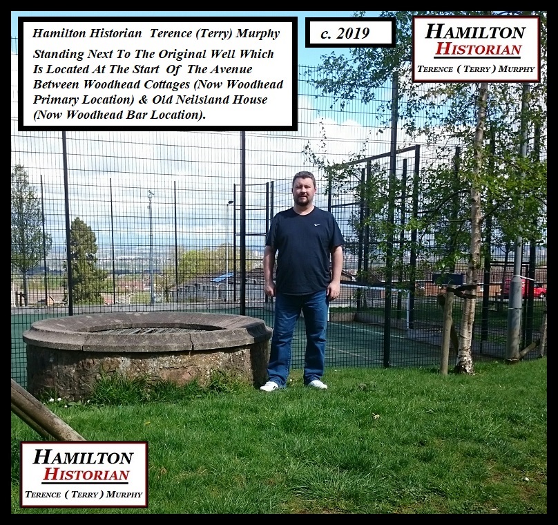
Hamilton Historian  Terence (Terry) Murphy Standing  Next To A Well At The Original Avenue Between Woodhead & Old Neilsland  c.2019.
neilsland-pheasantry
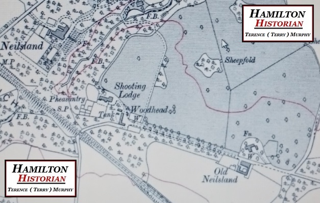
c.1910 map clipping showing Avenue and other Key Features of the estate.
swiss-cottage-replica-at-neilsland
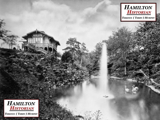
Swiss Cottage, Neilsland  c.1877.  Lord Byron Statue Is Visible Just Left of the Cottage.

f9a19-20190413_173502-1-1
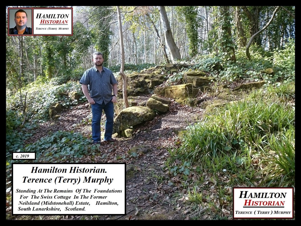
HAMILTON HISTORIAN  TERENCE (TERRY) MURPHY  AT THE FOUNDATION REMAINS OF THE SWISS COTTAGE  IN THE FORMER NEILSLAND (MIDSTONEHALL) ESTATE C.2019.

boathouse-at-neilsland-1877
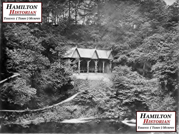
The Summer-House was constructed across from the Swiss Cottage  at a lower level on the other side of the pond.  This photo c.1877.
burnhouse-1877
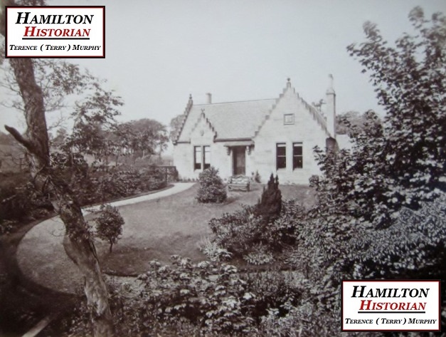
Burnhouse (Whisky Well Cottage)  c.1877.
20160321_154921
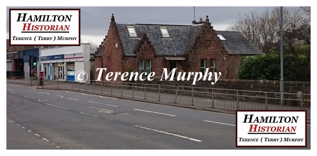
Burnhouse (Whisky Well Cottage)  c.2016. You can see the extension on the right of the building which was added during the 1990’s. Located at 51 Neilsland Rd, Hamilton, South Lanarkshire ML3 8HQ. It is a Grade C British Listed Building.

In May 1874 George Gordon gave up his lease of Old Neilsland House and Mr & Mrs David Laird Gibson took over as tenants. A few years later Mr Gibson died and on the 29th of April 1879 Sir John Watson Bt of Earnock married Harriet Drew Mackenzie (Gibson’s Spouse). John Watson’s first wife Agnes Simpson had died some years before.

In the year of 1879 Sir John Watson Bt of Earnock purchased the Meikle Earnock estate from Mr Matthew Dick Clelland. He also aquired the lands of Hollandbush from Mr Daniel Clark. Watson subsequently owned to properties at Hollandbush;  1): Oakenshaw, which he leased to the Cadzow Coal Company to use as a manager’s House. And 2): Fairview, both buildings no longer exist.

Statues by Carluke Sculptor Robert Forrest were purchased for the Neilsland Estate and  placed around the gardens and various spots within the glen. A full list of the statues can be seen in my other History note; “Earnock House & Estate”. No intact statues remain on the Neilsland Estate but there are the headless remains of “Lord Byron” and the commonly referred to “Little Feet” which is the remains of a baby boy statue called “The Infant Saviour” or “Promised Child”. This statue was cherub like in appearance and cemented to a stone pedestal at the end of a small footbridge crossing the weir. The metal angled bracket that was fixed to the head of the statue would have had a small saucer shaped cup for holding a candle that illuminated the bridge path as well as giving the illusion of a halo around the child’s head. 

_20190413_173316 1
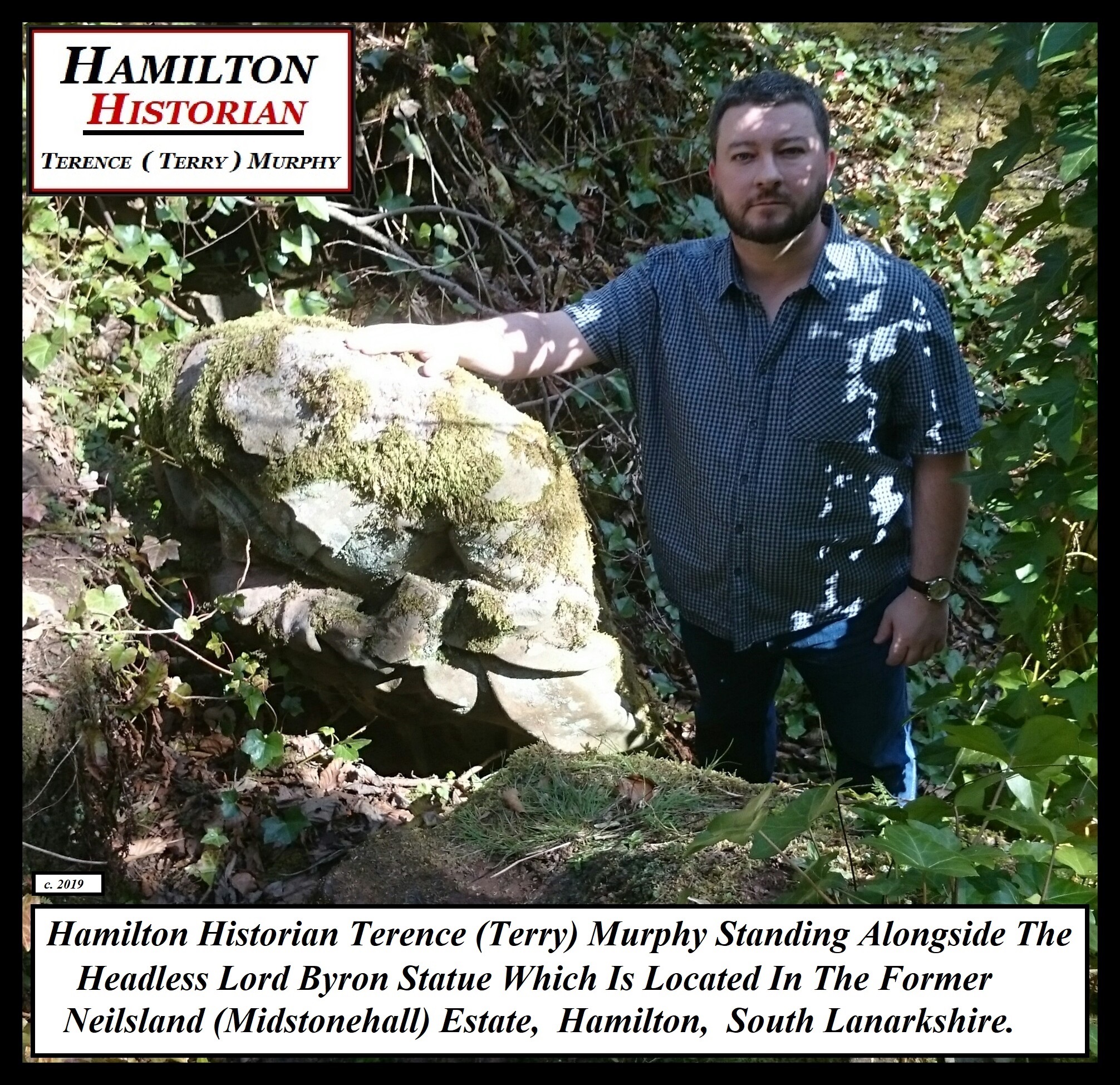
Hamilton Historian  Terence (Terry) Murphy With The headless remains of  Lord Byron located at the Rockery  c.2019.

SAMSUNG

Continue reading

The Ghoulish Desecration Of Meikle Earnock Burial Ground c.1895.

Poster - Copy

John Murphy,  a 14 year old boy who worked as a pony driver from Eddlewood was responsible for the ghoulish desecration  of the Meikle Earnock Burial Ground.  Murphy along with four of his friends met with each other on the afternoon of Sunday 14th April 1895. One of the lads informed the rest of the group that a vault in the graveyard was open. They made their way there and noticed that a group of other lads had gathered.

_20190408_214810 1

_20190408_215818

The location of the burial ground (now grassed area) is in  Fairhill,  Hamilton,  South Lanarkshire.  Scotland.  Between Millgate Rd & Neilsland Rd.

Murphy entered the open vault and lighted a match, according to a witness. He went  to one of the coffins that was lying open and had a number of loose bones in it and proceeded to open a coffin next to it! He put his hands in and extracted a skull from it and, then brought it out the vault displayed on the end of a stick. He threw the skull onto the ground and smashed it with the stick saying; he “wanted to know what was in it!”. The 14 year old then made his way back into the vault to bring out another skull and when his friends reacted  with concern he gave up the notion!

A few days before the incident a local police officer had visited the graveyard following a report that a vault was open. The door was sitting open by about 6 inches as it had been parted from the framework fixings. The officer fixed the door in such a way that it made the vault temporarily secure until the owners could have it repaired correctly. The officer also informed the court (who had John Murphy on trial) that the same vault had been broken into five years before. Coffin cords had been stolen and little girls from the village were at the time using them as skipping ropes! When the Sheriff   asked Murphy to explain his reason for committing such a ghoulish act. Murphy simply denied that he had lighted a match!

431291_10150700832882329_1530389795_n

In the above photo the circled red box marks the position of a former staircase.

The Sheriff   imposed a fine of 15s with the option of 10 days imprisonment by means of a “Warning” that the boy does not commit such a sacrilegious misdeed again!

Written by

Hamilton Historian.

Terence (Terry) Murphy.

*I first wrote and published this history note on 8th March 2016.*

ref. Hamilton Herald  page 4,  3/5/1895.

Meikle Earnock Burial Ground (18th Century) & Roman Tumulus.

_20190408_214359 1HAMILTON HISTORIAN   TERENCE  (TERRY) MURPHY  AT THE BURIAL GROUND AND ROMAN TUMULUS,  LOCATED IN HAMILTON,  SOUTH LANARKSHIRE,  SCOTLAND,  NEAR THE TOP OF NEILSLAND ROAD AT IT’S OPPOSITE END.
431291_10150700832882329_1530389795_nTHERE USED TO BE A STAIRCASE LEADING TO THE BURIAL GROUND, I HAVE CIRCLED THIS AREA IN RED IN THE ABOVE PHOTO.

The ancient inheritors of Fairhill Park (which included the mansion house) in the lands of the village of Meikle Earnock were the Strang Family. In 1654 when Laird “Old” James Strang was born he aquired the land (through inheritance and most likely purchased for him by an older relative.)

In 1731 Laird “Old” James Strang was very unhappy with the heritors of the town and their  decision to remove the Old Collegiate Church/Graveyard located at the Palace Grounds to relocate  the interred to the Old Parish Churchyard. He was most likely annoyed because he and his future descendants would not be buried alongside the Dukes. He decided to section off an area of the lands of Fairhill Park which was next to a Roman Tumulus (Burial Mound). This was so it could be used as a private burial ground/graveyard for his family and the feuars of the village of Meikle Earnock. A parameter wall and miniature mausoleum were also erected on site. His daughter Catherine Strang married John Mather in 1724. Laird “Old” James Strang died 1746 and is buried at the site.

The 2nd Laird James Strang (son of the above) inherited the lands when his father died. This Laird had three daughters; Janet, Mary and Nelly. Janet married Robert Mather in 1770 and the other two died unmarried. The Laird sold the lands of Fairhill Park during 1763 to Captain George Coventry under agreement that the burial ground should always be owned by the Strang and Mather family members and descendants. The 2nd Laird James Strang died 1777. Fairhill Park which included the mansion house was passed on through the Coventry Family and then to the Urquhart Family until the house was eventually demolished for the  development of the present day Fairhill  housing estate (council built). The exact location of the mansion house sat on a triangular shaped plot of ground in the centre of what is now known as Falconer Terrace (grassed area) next to Fairhill Avenue.

The burial ground was then held for a considerable time by the Mather Family of Meikle Earnock who came through it by marriage  into the Strang Family as mentioned above. It was last held by their descendant “Mr Dick” of Glasgow who eventually sold it to Sir John Watson 1st Bt of Earnock.

_20190408_214810 1

_20190408_215818THE AREA  I AM STANDING AT WAS THE LOCATION OF THE MINIATURE MAUSOLEUM, THE GRASSED AREA IN FRONT OF IT WAS THE SMALL BURIAL GROUND.
Fairhill & Tumulus MapOrdnance Survey Map Clipping Showing Burial Ground In A Small Walled Off Rectangular Area With The Circular Miniature Mausoleum In The Right Hand Corner. Just Outside It Is The Tumulus Marked As A Small Sunshine Type Symbol And The Formal Gardens Of The Fairhill Mansion House. Map Survey From c.1858, Published  c.1864.

DSC_0825

four headsThe Covenanter Martyr Christopher Strang who was the brother of Laird “Old” James Strang. This monument is located at Hamilton Parish Churchyard.

James Strang memorial

Robert Strang memorialPlease note that these are not the actual flat tombstones! I created them to give an idea of what they may have looked like. The inscriptions are however, correct. Both Laird “Old” James Strang and Robert Strang are buried at the site.

Written by

 Hamilton Historian

Terence  ( Terry )  Murphy.

Ref. Hamilton Old parish Church.Org-Publications.  Canmore, Hamilton, Fairhill Burial ground (18th Century).  Incidents In The Life Of The Late John Watson of Bathville  And Of John Watson Of Earnock, His Son 1889-section; Minor Holdings Of Earnock: The Taits, Stewarts, Machans, Hamiltons And Strangs.  Excerpt From Mather Family Bible July 15th 1887. 1842. Topographical. Statistical & Historical Gazetteer Of Scotland.